

Nepal Rasuwa Flash Flood: A devastating flash flood in Nepal’s Rasuwa region has drawn attention from scientists across South Asia. India’s National Remote Sensing Centre (NRSC), a key arm of the Indian Space Research Organisation (ISRO), has conducted an initial satellite-based assessment to understand the scale and possible cause of the disaster.
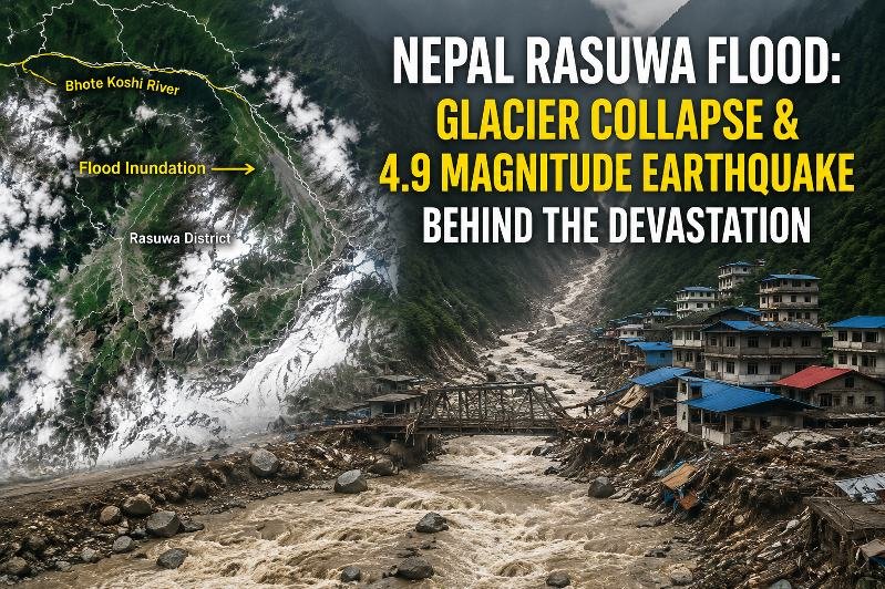
Using imagery from Indian and international satellites, NRSC scientists have mapped changes across the affected region and reconstructed the likely sequence of events behind what appears to be one of the most severe mountain-related disasters in the area in recent years. India currently has 56 satellites in orbit.
What Did the NRSC Assessment Find?
The NRSC assessment indicates that the disaster may have originated in the high mountains of Tibet. Preliminary analysis suggests that a magnitude 4.9 earthquake may have triggered the collapse of part of a cirque glacier.
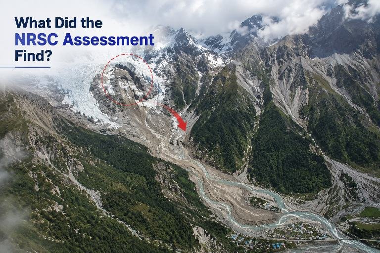
The collapse is believed to have sent a massive mixture of ice and rocks down a steep mountain valley. The avalanche may have temporarily blocked the river’s flow.
When that natural blockage eventually failed, a huge surge of water, mud, rocks and debris may have rushed downstream. The resulting flash flood rapidly spread through the Trishuli River system, causing sudden water accumulation and widespread destruction.
Scientists studying satellite imagery have identified the collapse of the cirque glacier, followed by an ice-and-rock avalanche, as a possible trigger for the disaster.
Magnitude 4.9 Earthquake Recorded
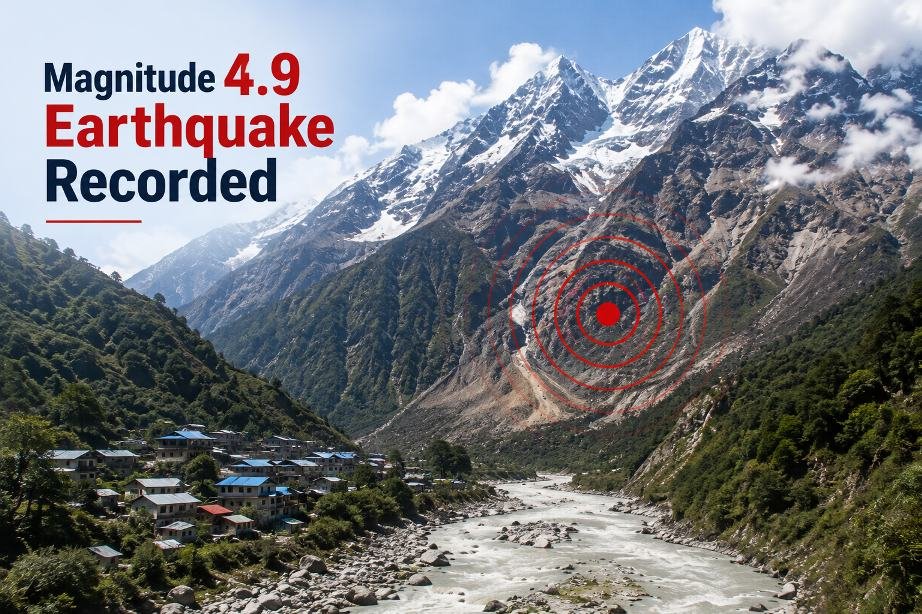
India’s earthquake monitoring network recorded a magnitude 4.9 earthquake at 8:22 am IST, at a depth of 10 kilometres.
The National Centre for Seismology (NCS) placed the earthquake at 28.076° latitude and 86.494° longitude, within the Rasuwa region. The Himalayan belt is highly vulnerable to earthquakes because of its active geological conditions.
To assess the extent and impact of the disaster, scientists at NRSC in Hyderabad carried out a rapid geospatial assessment.
They compared pre-disaster imagery captured by Europe’s Sentinel-2 satellite on August 24 with post-disaster imagery captured by ISRO’s Resourcesat-2A on August 26.
Scientists also examined fresh post-flood imagery along with an older Resourcesat-2A image from April 4, 2026. This comparison helped them identify changes in the landscape and locate areas affected by the disaster.
How Did the Flash Flood Happen?
The satellite comparison revealed significant changes in the river’s course. Large sections of the river system were affected by debris accumulation and flooding.
By comparing images taken before and after the event, scientists were able to map the altered terrain and develop a clearer understanding of how the disaster moved through the mountainous landscape.
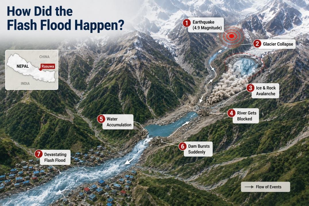
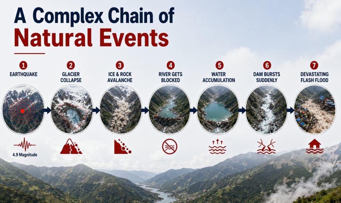
The evidence points toward a possible chain of events:
- An earthquake or other geological factors destabilised part of the glacier and surrounding terrain.
- A section of the cirque glacier may have collapsed.
- Ice and rocks rushed down the steep mountain slopes as a massive avalanche.
- The debris temporarily blocked the river.
- Water accumulated behind the natural blockage, forming a temporary reservoir.
- The blockage eventually failed.
- Water, mud, ice, rocks and other debris surged downstream, producing a destructive flash flood.
The combination of these events may have transformed a local mountain collapse into a powerful flood wave that travelled a considerable distance along the river system.
Why the Cirque Glacier Matters
The cirque glacier is considered an important part of the suspected chain of events.
A cirque glacier develops within a bowl-shaped depression along a mountain, where snow and ice accumulate over long periods. Such glaciers can also receive ice and debris from avalanches descending from higher slopes.
When geological or weather-related conditions disturb the stability of these formations, large quantities of ice, rocks and other material can move rapidly downhill.
Initial analysis suggests that a similar process may have occurred in Tibet, setting off a chain reaction that eventually contributed to the devastating flood in Nepal.
Scientists analysing the satellite data believe the sequence may have involved the movement of ice and rocky debris, temporary blockage of the river, formation of a water-filled reservoir and the sudden release of the accumulated water and debris.
Satellite Technology Helps Track Mountain Disasters
The Rasuwa flood has once again highlighted the growing importance of space-based technology in disaster management.
Satellite monitoring is increasingly used to observe and assess floods, landslides, cyclones and forest fires, particularly when ground access is difficult or dangerous immediately after a disaster.
In the Rasuwa case, comparing satellite images from before and after the event allowed scientists to quickly identify affected areas, map major changes in the terrain and investigate the possible causes of the flooding.
Such rapid geospatial assessments can provide valuable information to emergency responders, authorities and scientists working to understand and manage disasters in vulnerable mountainous regions.
A Complex Chain of Natural Events
The preliminary satellite analysis suggests that the Rasuwa disaster may not have been caused by a single event. Instead, an earthquake, glacier instability, an ice-and-rock avalanche, temporary river blockage and the sudden release of stored water may have combined to produce the devastating flash flood.
While further investigation will be required to establish the exact sequence and confirm the role of each factor, the early satellite evidence provides an important picture of how a relatively local event in the high mountains could develop into a large-scale disaster downstream.
The findings also demonstrate how satellite imagery can help scientists reconstruct rapidly changing events in remote Himalayan terrain and improve understanding of future mountain hazards.